
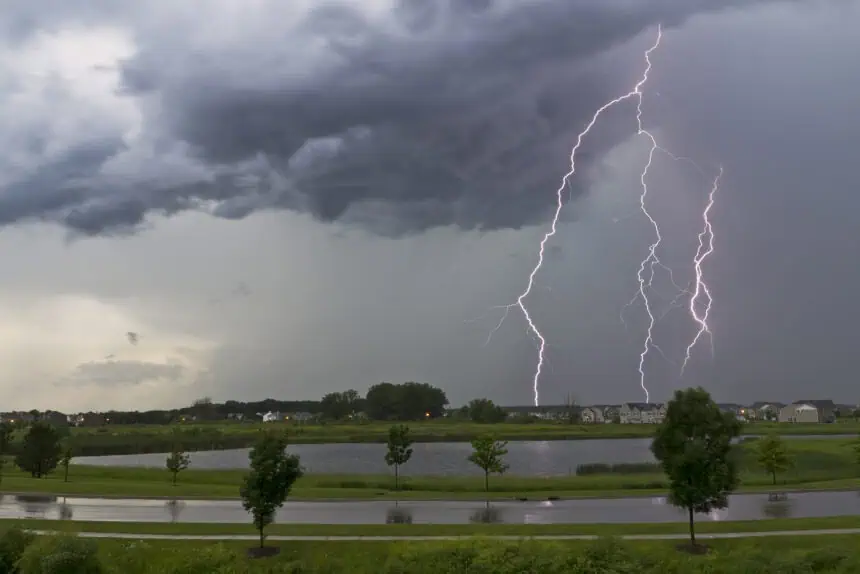

Scattered thunderstorms are expected to affect large portions of Illinois today, potentially causing localized flooding, lightning, and damaging winds just as the Fourth of July approaches. High humidity and heat index values near 100°F (38°C) will intensify the discomfort, especially in urban areas.
Fog advisory early Monday in northwestern Illinois
Dense fog developed early this Monday morning across parts of northwestern Illinois, especially around Galena, Monmouth, and the Quad Cities. The fog has been most intense in low-lying zones, with visibility dropping below ½ mile. Conditions are expected to improve by 8 a.m., but early commuters in the region should remain alert.
Storm alerts across Illinois
Throughout the day and into the night, scattered storms will affect much of the state, with some cells capable of producing heavy downpours, urban flooding, and gusts up to 60 mph (97 km/h). In isolated spots, lightning and falling tree limbs could become hazardous.
Central Illinois weather forecast
Monday: Expect scattered thunderstorms and humid conditions, with highs between 85°F and 90°F (29°C–32°C).
Tuesday: Skies will be partly cloudy, with temperatures from 84°F to 87°F (29°C–31°C).
Wednesday: Another partly cloudy day with highs ranging from 86°F to 89°F (30°C–32°C).
Thursday: Continued sun with a few clouds, and temperatures reaching 89°F to 91°F (32°C–33°C).
Friday: Warmer and humid, with partly cloudy skies and highs from 90°F to 93°F (32°C–34°C).
Chicago area forecast: Humid and stormy by week’s end
Monday: Expect humid conditions and a chance of scattered storms. Temperatures will reach 85°F to 90°F (29°C–32°C), but will be cooler along the lakefront.
Tuesday: Less humid with sunny skies and highs between 81°F and 86°F (27°C–30°C).
Wednesday: Partly cloudy with temperatures from 85°F to 90°F (29°C–32°C). Cooler conditions expected near Lake Michigan.
Thursday: A chance of thunderstorms with highs from 88°F to 93°F (31°C–34°C).
Friday: Storms remain possible as temperatures rise to 90°F–95°F (32°C–35°C). Expect heat index values nearing 100°F (38°C) in Chicago and surrounding areas.
Weather radar coverage for central Illinois shows scattered storm cells developing, with heavier precipitation bands likely forming throughout the day. Keep watch for flash flooding, especially in low-lying urban zones across Peoria, Bloomington, and Springfield.


