

Severe overnight storms batter North Texas
Dallas and surrounding areas in North Texas endured a violent line of thunderstorms late Sunday night, continuing into early Monday morning, unleashing damaging straight-line winds with gusts surpassing 80 mph (129 km/h). Some localized wind speeds may have reached 95 mph (153 km/h). The National Weather Service classified the event as a “Particularly Dangerous Situation” (PDS)—a rare and serious designation reserved for threats with long-lived and violent tornado potential.
Widespread structural damage was reported, including fallen trees and at least one roof torn off a building in the Dallas-Fort Worth Metroplex. Roads are becoming impassable in certain spots due to flooding.
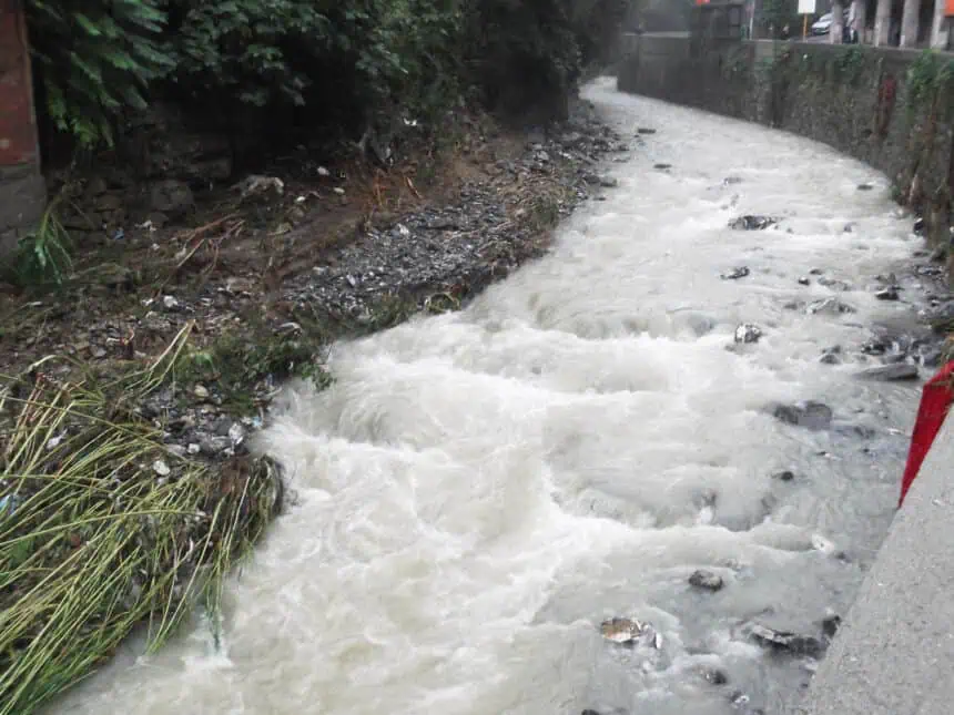
Flash flooding concerns rise across multiple counties
A Flash Flood Warning remains in effect for Dallas, Tarrant, Collin, and Denton Counties through early Monday morning, following intense and prolonged rainfall. The combination of saturated soil and urban runoff has caused localized flooding in several low-lying areas. These weather conditions pose serious threats to travel and infrastructure.
Counties under warning and severe threat outlook
The Storm Prediction Center issued a Level 4 out of 5 “moderate risk” designation for a large portion of North Texas, signaling the high potential for a significant severe weather outbreak. Severe Thunderstorm Warnings remain in effect for counties including Anderson, Freestone, Henderson, Hill, Kaufman, Limestone, Navarro, and Van Zandt until 2:15 a.m. CDT.
Timeline and forecast details
The storm line moved into northwestern North Texas around 8:00 p.m. CDT, hitting the Metroplex between 10:00 p.m. and midnight, and exiting to the east and southeast between 1:00 a.m. and 2:00 a.m. Monday. The initial storms, especially those from the northwest, carried the highest tornado and hail threats, while the main line brought the most powerful wind gusts.
Earlier in the day, scattered thunderstorms and showers affected the eastern and northeastern counties, with some cells over the Red River producing hail.
Governor Abbott deploys emergency response units
Texas Governor Greg Abbott announced that additional emergency resources are being activated in response to the severe weather and flooding threat. The following state agencies are actively involved in the ongoing response:
Texas A&M Task Forces, National Guard, Parks and Wildlife, DPS, and the Department of State Health Services, among others, have deployed search and rescue teams, swiftwater boat units, hoist-capable helicopters, ambulances, disaster recovery agents, and roadway crews. These teams are operating throughout North Texas, prioritizing flood rescues, road clearance, and medical support.
Residents are encouraged to check TexasFlood.org and local alerts for flood-related information.
Looking ahead: more storms expected this week
The active weather pattern will likely persist through the week, with multiple rounds of showers and thunderstorms forecasted between Tuesday and Thursday. These may bring additional heavy rainfall, compounding current flood risks.
Severe weather awareness will remain crucial as North Texas faces what may be the most significant severe weather event of the spring season, driven primarily by extreme wind events capable of producing damage equivalent to low-end tornadoes.


